|


| |

Historic Trails!
|
These are the WITCH
TRAIL COMMITTEE Historic Hiking Trails around the
Boston area. |
| Each of these trails can be hiked by both young and old. There are 3 that
were designed in mind for the younger scouts, as they are shorter in
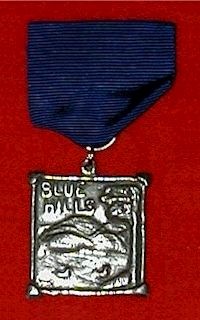
length. At the conclusion of each hike there are awards that can be
purchased. Each hike has a fully multicolored embroidered patch along with
a hand poured pewter medal. |
Click on Images to Enlarge!
Copyright©
2002; The Witch Trail Committee
|
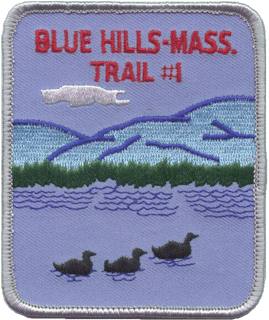
Blue Hills
#1 and Blue Hills #2 |
|
|
Blue Hills #1 and Blue
Hills #2 are a 2-mile
and an 8-mile hike through the Blue Hills in Milton, Massachusetts, just
south of Boston. The Blue Hills are an ancient landmark used by very
early indigenous people of the area and it is suggested that the Native
American words for Blue Hills (Masua Tuset) gave rise to the state’s name,
Massachusetts. It is known that the Blue Hills were a renowned meeting
place for the local native peoples, and it is also known to be an area
quite rich in flint, a stone used quite extensively by the local
inhabitants of the time in making arrowheads and other simple tools.
Both trails begin at
the Trailside Museum. The shorter #1 trail is a less difficult and
shorter trail recommended for the younger youth. It goes to the top of
“Big Blue” and returns to the museum, while the longer and more difficult
#2 trail goes a quarter of the way around the base of “Big Blue” and up
the steeper, more rugged southwest face. Both trails come to the top of
“Big Blue” where hikers can climb an observation tower and see spectacular
views of Boston and the Boston Harbor to the north, the towns of
Dorchester and Quincy and the Atlantic Ocean to the east, and
Narragansett Bay in Rhode Island to the south. On a clear day, visitors
can see the White Mountains of New Hampshire as well as the northern tip
of Long Island, New York.
Along the trail,
hikers can observe native vegetation and wild life. This is an excellent
area for a nature hike if familiar with the local flora and fauna. During
the summer months there are wonderful “high bush” blueberries ripening
along the trail. It is recommended that hikers bring drinking water as
well as a snack. In addition, it is recommended that hikers wear a good
pair of supportive hiking boots as the terrain can be rugged and or
slippery at times.
The #2 hike continues
down the east face of “Big Blue” and up and over Houghton’s Hill, around
the north base of Houghton’s Hill and “Big Blue” and ends back at the
museum where it began.
|
|
Blue Hills Trail #1: |
|
|

|
Item # |
WTCBH1 |
|
Price |
$2.50 |
| |
|
|

|
Item # |
WTCBHR1 |
| Price |
$5.00 |
| |
|
|
| Blue Hills Trail #2: |
|
|

|
Item # |
WTCBH2 |
| Price |
$2.50 |
|
|
|

|
Item # |
WTCBHS1 |
| Price |
$5.00 |
| |
|
|
|
|
|
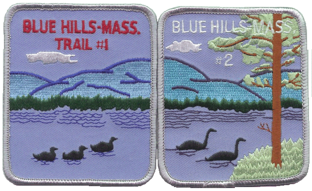
Blue Hills Trials 1 & 2: |
| |
The Blue Hills Trails Patches are Panoramic Patches; they can be
placed
together to create a scene on a Brag Vest or Jacket. |
|
|
 |
|
|
|
 |
|
|
|
Pirate Legend & Trek
Trails: |
|
|
Pirate Legend Trail (10 mile hike
recommended for older youth and adults) and Pirate Legend Trek ( 4 mile
hike for all age groups) are both circular hikes in Lynn Woods in the town
of Lynn, Massachusetts. This area is rich in pirate history from the mid
1600’s. A nearby bog iron works in Saugus, Massachusetts was a coastal
location frequently visited by pirate ships in need of shackles,
handcuffs, hatchets, chains and other iron articles. The Iron Works is
operated by the National Park Service today and is a very popular
attraction. Legend has it that four pirates made their home in Saugus
near what is today called Pirate’s Glen, but were soon found out and
pursued by the King’s men. One man escaped to Lynn Woods and lived there
in a cave for several years before taking up residence in the village of
Lynn. The cave is still a very popular site with visitors. Local stories
tell of a treasure that was taken into Lynn Woods by pirates and buried
there. Many people have searched for the treasure, digging in the bogs
and swamps and even into solid rock, but no one has ever claimed finding
the treasure.
|
Along both the Trail and the Trek
you will see: |
| Breed’s Pond |
Burrill Hill |
Tomlin’s Swamp |
| Birch Pond |
Dungeon Hill |
Ramsdell’s Swamp |
| Balanced Boulder |
Vinegar Hill |
Weetamo Cliff |
| Skull Rock |
Mount Gilead |
|
If you plan to go into the cave,
be sure to bring flashlights and a good rope. There is room for up to
twenty people at a time in the cave, but use caution for it is often very
wet inside. Along the paths you will come to many scenic views, and from
atop the hills you will see the Saugus River, the towns of Saugus and
Lynn, and the Atlantic Ocean. The area has a good size parking lot and a
picnic area. There are no toilet facilities near by and there is no water
supply. |
|

|
Item # |
wtcpltp1 |
| Price |
$2.50 |
| |
|
|

|
Item # |
wtcptp1 |
| Price |
$2.50 |
| |
|
|
|
|

|
Item # |
WTCPLTM1 |
| Price |
$5.00 |
|

|
Item # |
WTCPTM1 |
| Price |
$5.00 |
|

|
Item # |
WTCPTM2 |
| Price |
$5.00 |
|
|
|
|
|
|
|
|
|
Leslies Retreat Trail: |
|
|
Leslie’s Retreat is a 6 or a 10
mile hike from Marblehead to Salem, Massachusetts.
This trail traces the British march
of February 26, 1775 in search of American cannons. This march was the
first expeditionary mission of the British in the colonies and hikers
learn how the local residents reacted to the British, what led to the
events of April 19th, and explains why the British troops were
so tense at Lexington Green.
This trail can be hiked as either a
one-way six-mile hike from Marblehead to Salem or as a ten-mile roundtrip.
The trail can be hiked year round. Allow 3 to 4 hours for the one way and
5 to 6 hours for the round trip.
| Sights along the trail include: |
| Fort Sewell, a revolutionary fort
and gun emplacement built to safeguard Boston harbor from British
invasion. |
| Marblehead Town Hall, where
hikers can view the original painting of The Spirit of ‘76. |
| The South Bridge where residents
removed planks to slow the progress of the advancing British troops. |
| Site of the old mill where the
colonists had stored the cannons and munitions. |
| The north bridge across the North
River where Minutemen had raised the drawbridge and a tense verbal
encounter took place between them and the British commander, Colonel
Leslie. |
| The Minuteman Statue marking the
point at which the Minutemen had stood their ground and stalled for
time while the cannons were hidden and other militia men could
arrive to lend support. |
Seeing that it was useless to
search for the cannons after so much time had elapsed, Col. Leslie agreed
to a proposition to have the bridge lowered, to march only 500 feet on the
other side of the bridge, to not search for the cannons, and to
immediately return to the town of Marblehead. He did so and the entire
British company was verbally harassed and taunted as they “retreated” back
to their ship for a short sail back to Boston. |
|

|
Item # |
WTCLRP1 |
| Price |
$2.50 |
| |
|
|

|
Item # |
WTCLRM1 |
| Price |
$5.00 |
| |
|
|
|
|
|
|
|
Sky Line Trail: |
|
|
The Skyline Trail is a
7-mile circle trail through Middlesex Fells woods near the towns of
Stoneham, and Medford, Massachusetts. The hike is through woods and
requires hiking over several hills. Not recommended for younger youth who
are not accustomed to long str colspan="5">
|
|
|
|
|
|
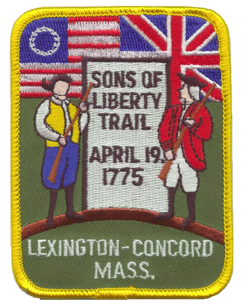
Sons of Liberty Trail: |
|
|
The Sons of Liberty
Trail is 10-mile hike from Lexington to Concord, Massachusetts following
the “battle road”. This trail traces the events of April 19, 1775, the
beginning of military action between the British and the colonists in the
American Revolution.
This trail follows city streets and busy county and state
roads and is not recommended for youth younger than 12 years of age;
however, the sights in Lexington and Concord, as well as those along the
way are certainly worth while for the younger set if the group is being
followed or accompanied by vehicles.
The trail begins at
Lexington Green where about 40 Minutemen met the British who were marching
to Concord to confiscate colonial cannons. This is the sight of the “shot
heard ‘round the world.”
| Sights along the
route include: |
| |
Buckman Tavern, a Minuteman
meeting place in Lexington. |
| |
The Hancock-Clark House, home of
John Hancock. |
| |
The house of Jonathan Harrington,
a Minuteman who was wounded at Lexington Green and who later that
day died of his wounds. |
| |
The Minuteman Boulder. |
| |
The Old Burial Ground. |
| |
Hayward’s Well, who
challenged a British soldier at his well…they shot and killed each
other. |
| |
Site where Paul Revere was
captured. |
| |
Bloody Angle, a bend in the road
where many British were killed or wounded. |
| |
Meriam’s Corner, site of another
small skirmish. |
| |
The Old North Bridge, where
the British were turned back, without a single shot being fired. |
| |
|
There are two rather
good museums along the route, both free when last visited. Often in
better weather, especially on summer weekends, members of reenactment
groups can be be found at these sites.
|
|

|
Item # |
WTCSOL1 |
| Price |
$2.50 |
| |
|
|
|

|
Item # |
WTCSOLM1 |
| Price |
$5.00 |
| |
|
|

|
Item # |
WTCSOLM2 |
| Price |
$5.00 |
| |
|
|
|
|
|
|
|
|
|
|
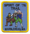
Spirit of '76 Trail: |
|
|
The Spirit of ’76 Trail is a two
mile hike through the historic town of Marblehead, Massachusetts on the
North Shore of the Boston area. This trail was designed with younger
hikers in mind.
| Sights along the trail include: |
| The original painting “The Spirit
of ‘76” in the Town Hall |
| The homes of Col. Jeremiah Lee,
King Hooper, Gen. John Glover |
| The 1680 Tavern |
| The Lafayette House |
| Lovis Cove |
| Ft. Sewell, a revolutionary fort
and gun emplacement built to protect Boston Harbor |
| Old Burial Hill, final resting
place of over 600 revolutionary soldiers |
| The Witch House |
| The home of Eldridge Gerry, a
signer of the Declaration of Independence |
| St. Michael’s Episcopal Church |
| Tory Headquarters, a meeting
place for colonists loyal to the King |
| The Old Town House, where General
Glover recruited the first US Marines during the Revolutionary War. |
The area is rich in Revolutionary
history as well as legends and stories of witches, ghosts, and pirates |
|
|
Item # |
WTCSOL1 |
| Price |
$2.50 |
| |
|
|
|
|
|
|
|
|
|
|
Witch Trail
Salem, MA: |
|
|
The quaint little
North Shore town of Danvers, Massachusetts, was formerly known as Old
Salem Village. We remember Old Salem Village as being the center of the
historic colonial “1692 Witch Hysteria”. The Witch Trail is a 10 mile
hike from Danvers to Salem, open year round, and will require 4 to 5 hours
to complete, depending on the amount of time spent viewing each of the 13
historic sites.
Hikers will see among other
things, the Wadsworth House where once stood the original home of an
accused witch, foundations of the Reverend Parris’ house where his West
Indian servant first told island stories of voodoo and witchcraft to
impressionable young girls, the Ingersoll House where several of the accused were first questioned, Watch House Hill where a new church was
built after the hysteria to reunite the people under the Reverend Green,
the Haines House whose owner testified against witches who were later
hanged, the home of Sarah Holten who testified against the 71 year old
Rebecca Nurse, the home and grave of Rebecca Nurse, a reconstruction of a
house which was used to interrogate and examine several of the women after
the initial accusations, and the Charter Street Burial Ground where
several famous people of the witch hysteria were laid to rest.
Several of the sites along
the way are open for tours; prices may very from site to site. Other
sites can be toured by prearranged appointment.
|
|

|
Item # |
WTCSP1 |
| Price |
$5.00 |
| |
|
|
|

|
Item # |
WTCSW3D |
| Price |
$5.00 |
| |
|
|

|
Item # |
WTCSWRD |
| Price |
$5.00 |
| |
|
|
|
|
|
Copyright©
2002; The Witch Trail Committee
  
|